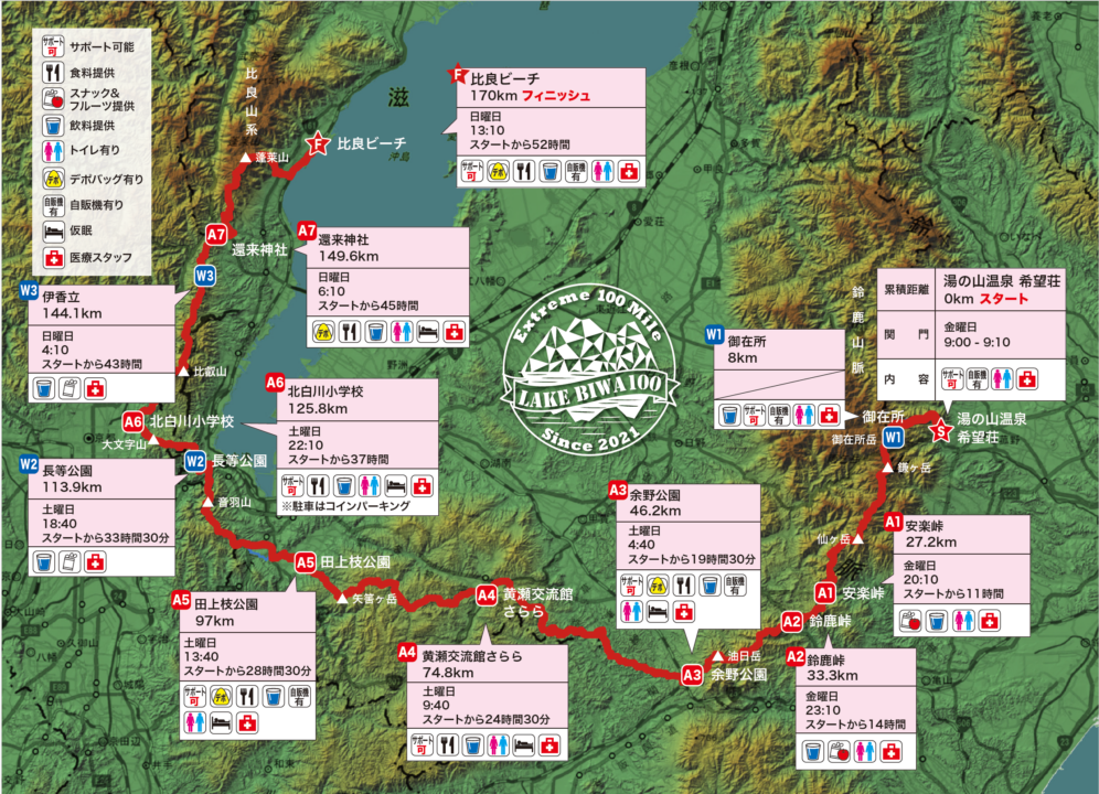
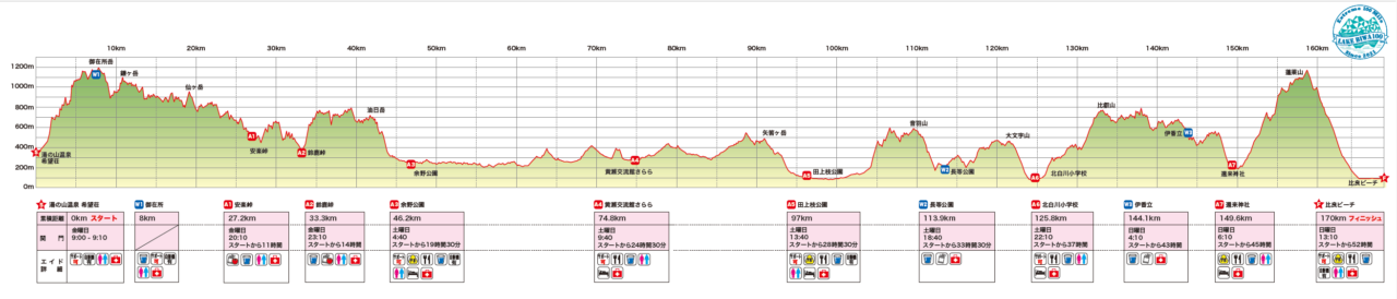
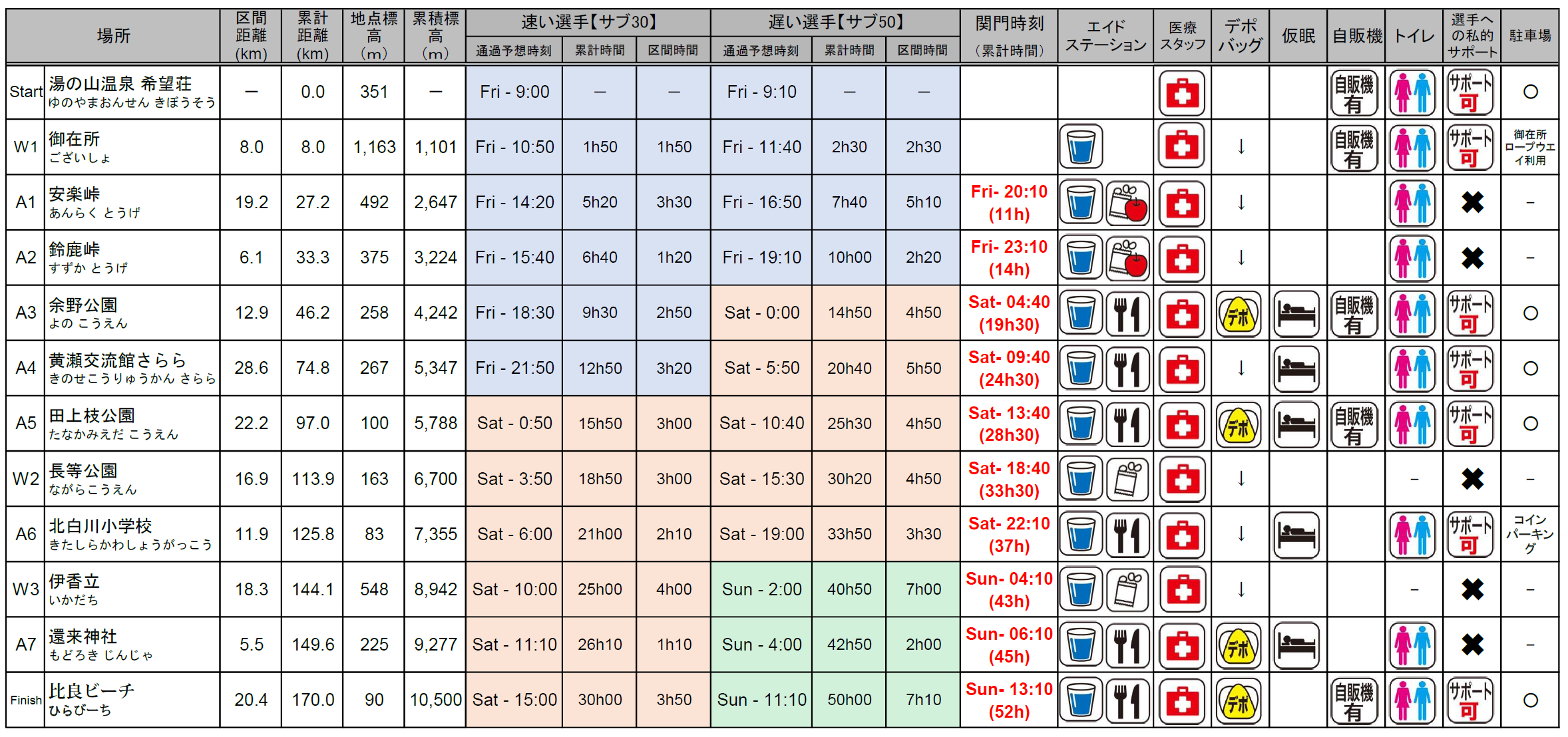
三重県菰野町の湯の山温泉 希望荘をスタートして、滋賀県大津市の比良ビーチを目指す距離170km、累積標高10,500mD+のコースです。
IBUKIでGPXファイルを公開・配布していますので、レース前に各自コースの詳細を必ず確認してください。
IBUKI イベントページ (各エイドの詳細な位置もこちらからご確認いただけます。)
※ IBUKI上で表示される距離は実測値より少なく表示されていますが計測方法の違いによるものです、ご了承ください。
※ 今年のコースは蓬莱山以降が若干変更になっております。最新のGPXファイルをダウンロードしてお使いください。
目次
- ①Start(希望荘)0km~A1(安楽峠)27.2km A1関門時間 11時間(金曜日 20:10)
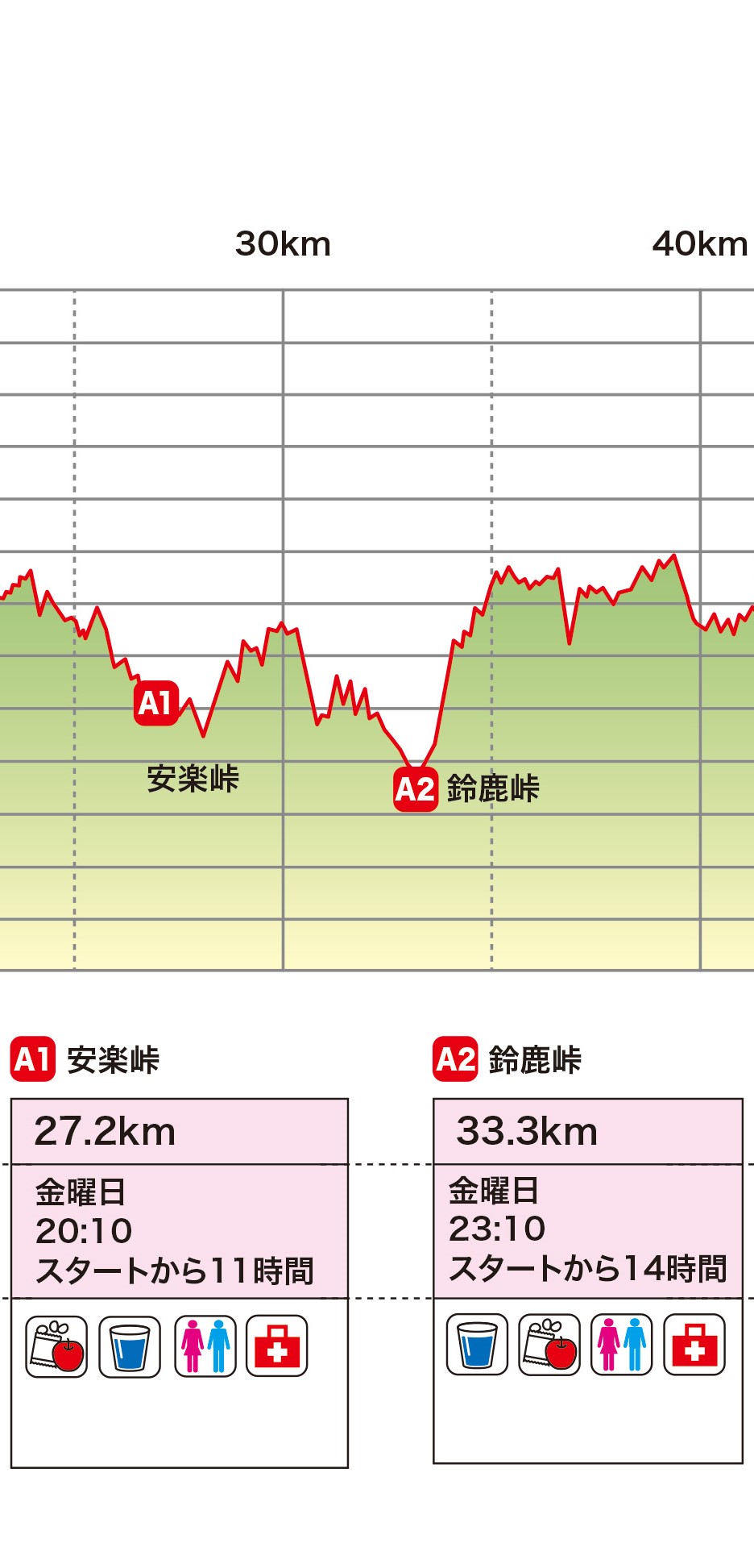
- ②A1(安楽峠)27.2km~A2(鈴鹿峠)33.3km A2関門時間 14時間(金曜日 23:10)
- ③A2(鈴鹿峠)33.3km~A3(余野公園)46.2km A3関門時間 19時間30分(土曜日 4:40)
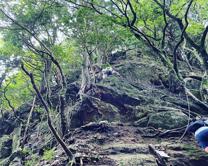
- ④A3(余野公園)46.2km~A4(黄瀬交流館さらら)74.8km A4関門時間 24時間30分(土曜日 9:40)
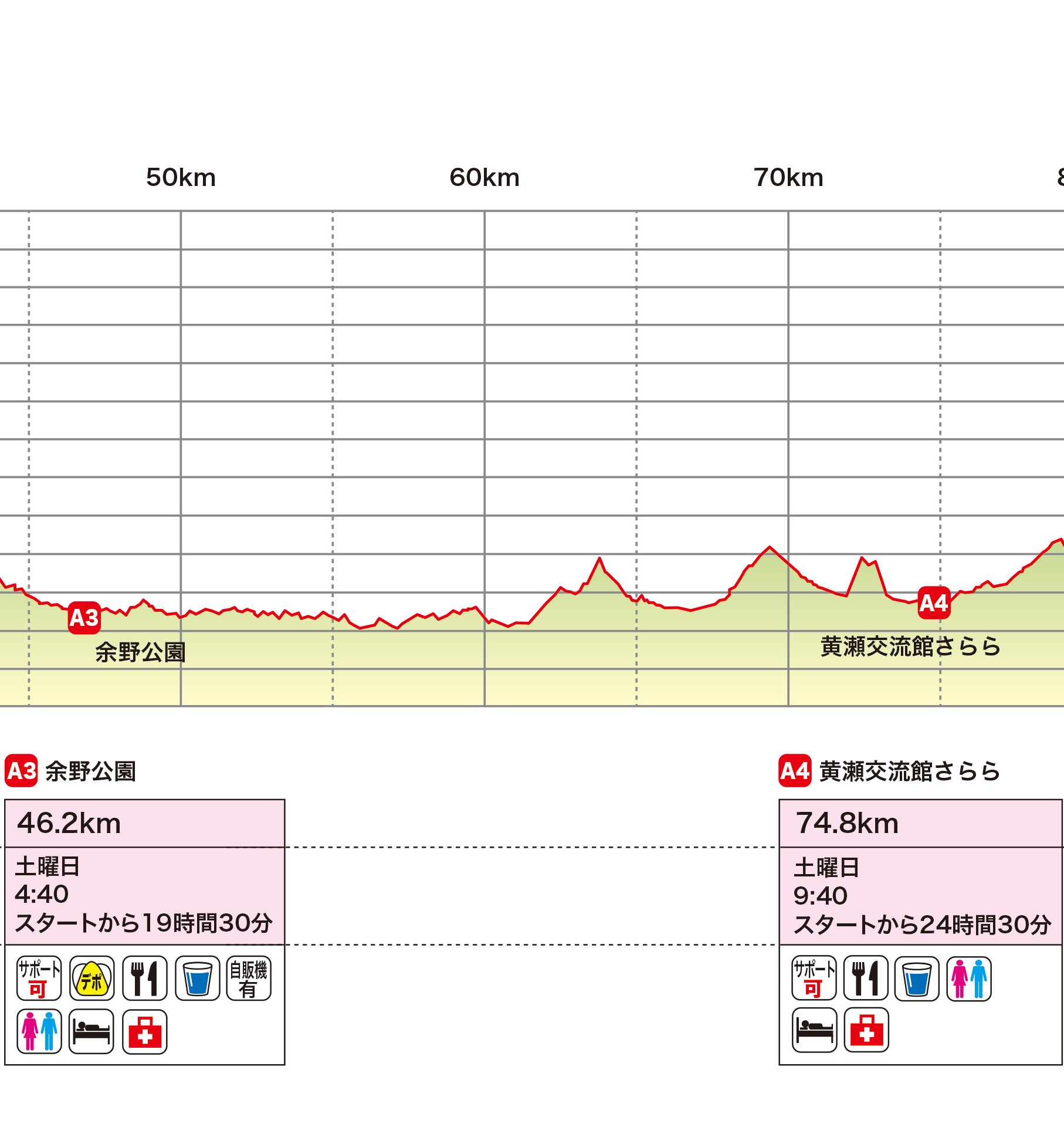
- ⑤A4(黄瀬交流館さらら)74.8km~A5(田上枝公園)97km A5関門時間 28時間30分(土曜日 13:40)
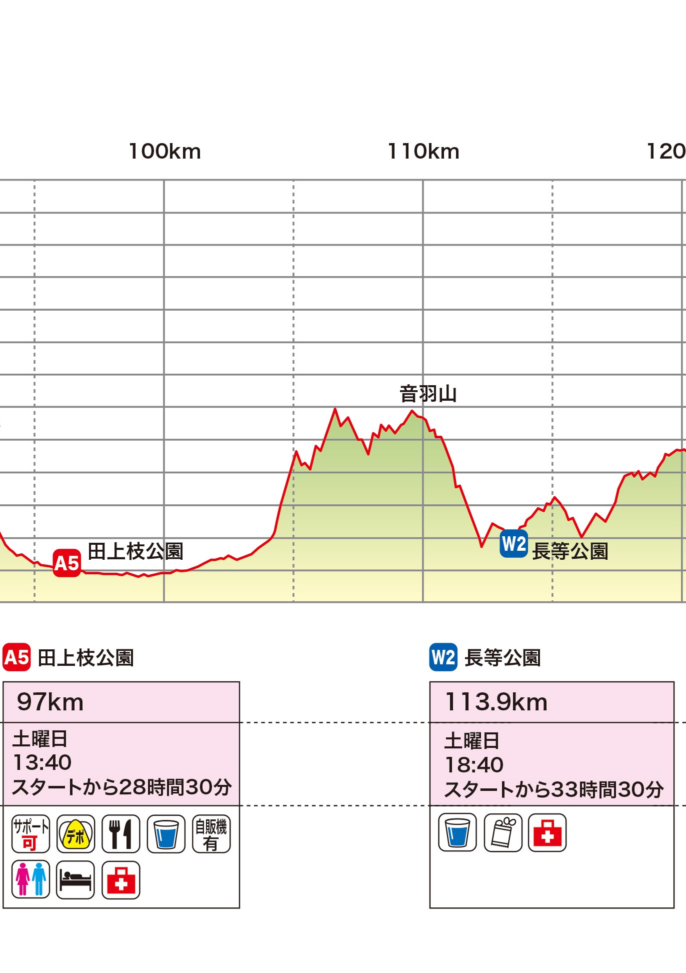
- ⑥A5(田上枝公園)97km~W2(長等公園)113.9km W2 関門時間 33時間30分(土曜日 18:40)
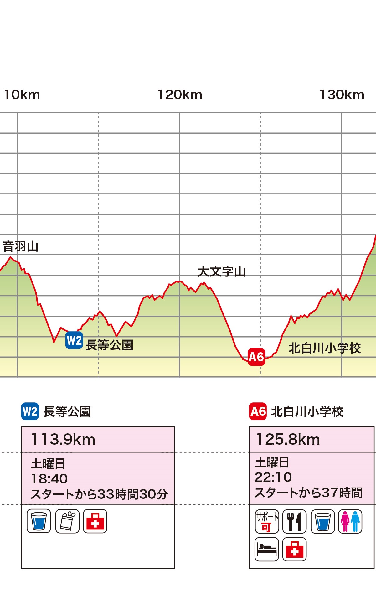
- ⑦W2(長等公園)113.9km~A6(北白川小学校)125.8km A6関門時間 37時間(土曜日 22:10)
- ⑧A6(北白川小学校)125.8km~A7(還来神社)149.6km A7関門時間 45時間(日曜日 6:10)
- ⑨A7(還来神社)149.6km~Finish(カーメルビーチクラブ前ビーチ)170km Finish関門時間 52時間(日曜日 13:10)
- 注意事項
①Start(希望荘)0km~A1(安楽峠)27.2km A1関門時間 11時間(金曜日 20:10)
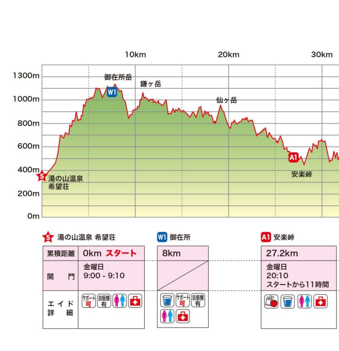
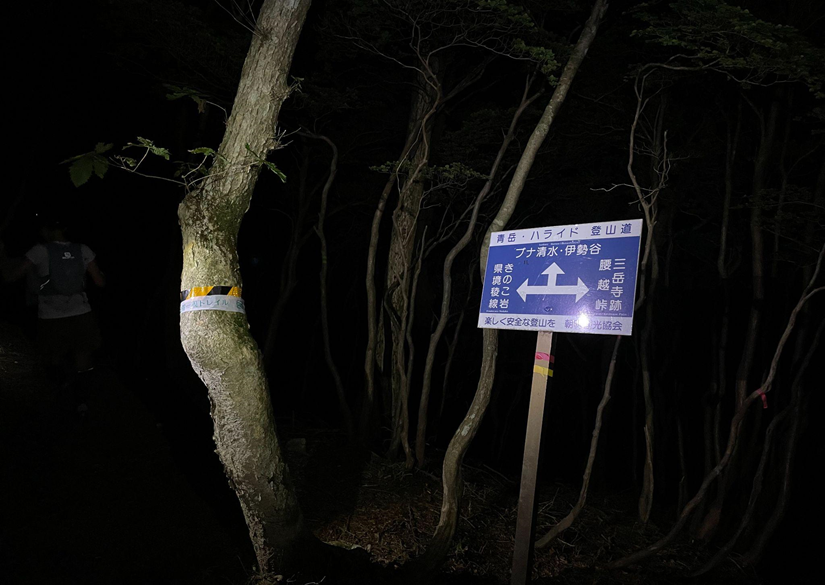
・ブナ清水(5km)~イワクラ尾根分岐(14km)までの約9kmは、国定公園の特別保護区となっており、ポールの使用は控え、徐行してください。ハイカーの比較的多いエリアになりますので、すれ違う際は歩いてください。
徐行区間のはじまりと終わりには標識を掲示しているので、標識に従うこと。
・御在所岳のピークを必ず通過すること
・御在所岳にはウォーターエイド、自販機とトイレあり
・御在所岳はサポート可(ロープウェイを利用してください)
・御在所岳周辺はハイカーや観光客を最優先
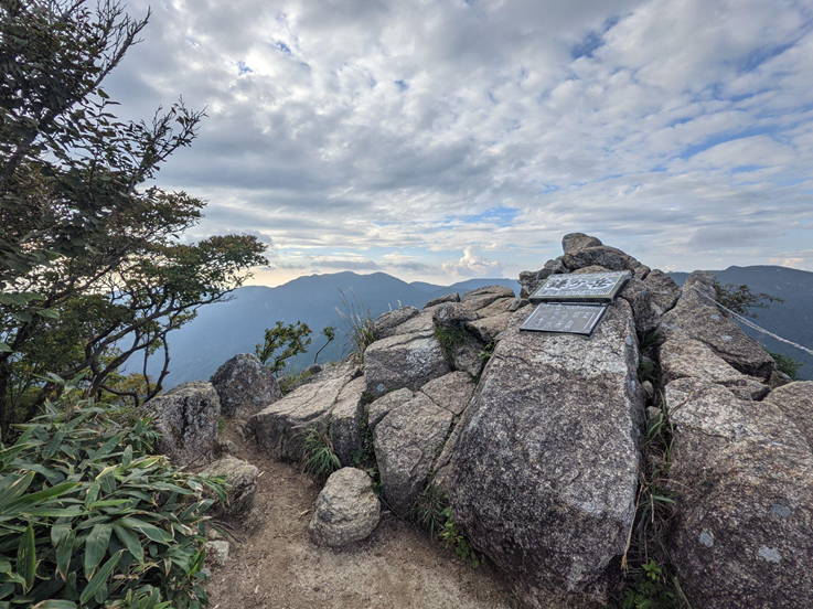
・鎌ケ岳の登り以降は上り下りの危険個所(鎖場)が多いので要注意
・仙ケ岳~安楽峠の間で多くの選手は日が暮れるため、ライトの準備要
・A1安楽峠は、駐車スペースがないためサポート禁止
・トイレはレース当日のみ簡易トイレ設置
厳しい山岳地帯なので、足元、マーキングに気をつけてすすもう!
②A1(安楽峠)27.2km~A2(鈴鹿峠)33.3km A2関門時間 14時間(金曜日 23:10)
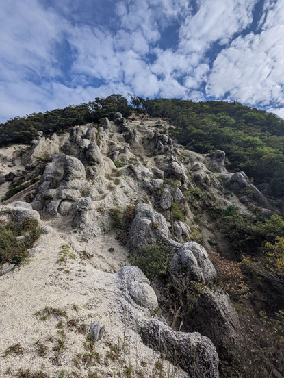
- 安楽峠直後の急登は、やせ尾根で岩場のため落石の恐れあり。十分に前後走者との間隔を空け、落石させてしまった場合は大きな声で後続者に伝えること。
- 四方草山(しおそやま)前後はやせ尾根の連続。踏み外すと滑落の恐れ大。細心の注意を払い走行のこと。
距離は短いけど、時間がかかる区間。距離が短いからと油断せず、十分な水分をもって進もう。
③A2(鈴鹿峠)33.3km~A3(余野公園)46.2km A3関門時間 19時間30分(土曜日 4:40)
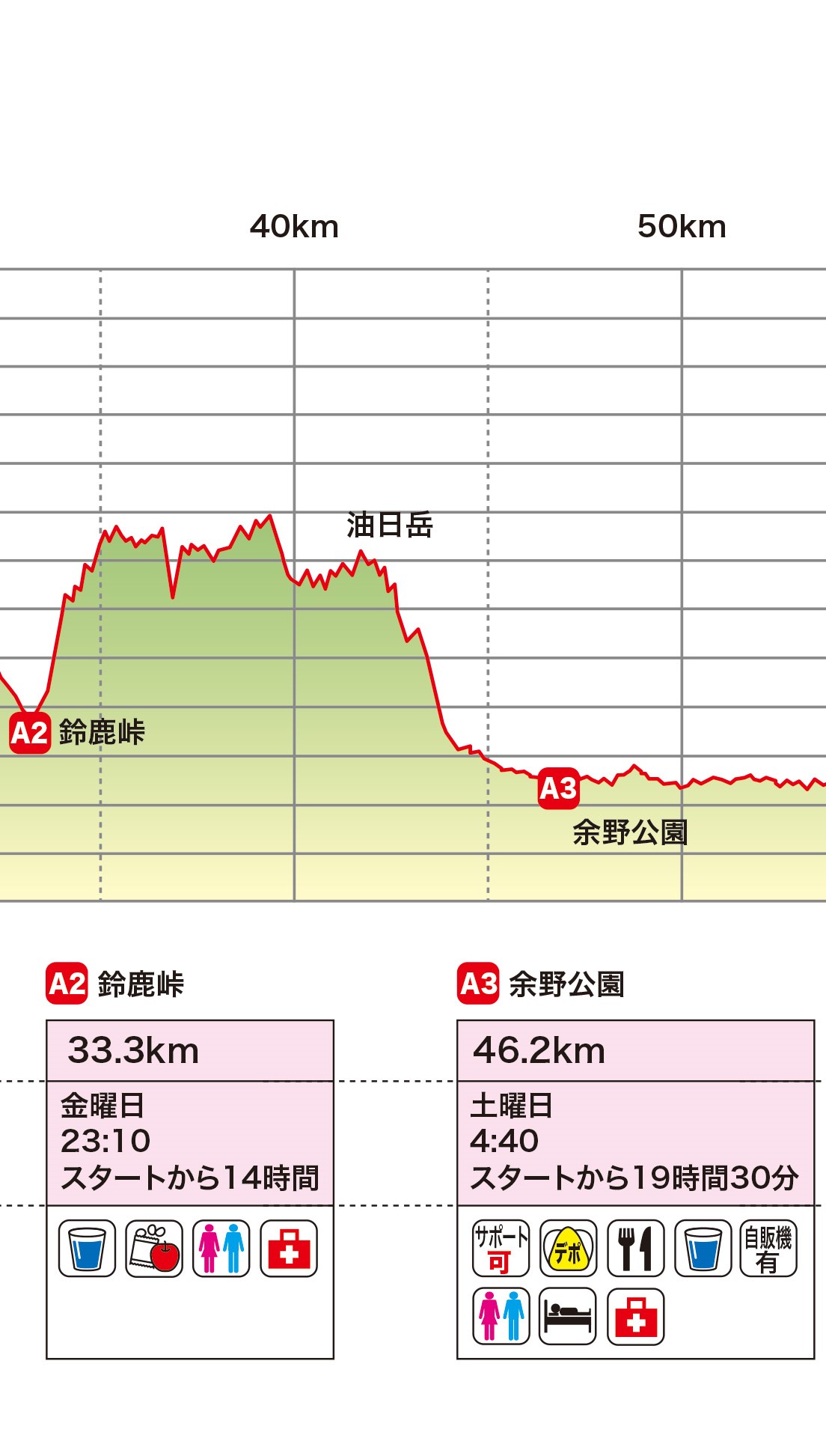
- 鎖場・ロープ場があり細心の注意を払うこと
- 細尾根に注意して走行すること
- デポバッグ有り・仮眠場所あり(各自デポバッグに寝袋などを入れておくこと)
思ったより時間がかかるため、水分を十分に持って、集中力を切らさずすすもう!滑落注意!
A3はカレーだ♪
落石の恐れあり、またロープの使用で複数人が同じロープにつかまると危ないので、適度な間隔をあけ、自分が次のロープをつかんだら、後続者に伝える。
④A3(余野公園)46.2km~A4(黄瀬交流館さらら)74.8km A4関門時間 24時間30分(土曜日 9:40)
- 基本的には、東海自然歩道の道標を辿る、ロード・林道・里山トレイルが続く
- 道を横断する際は、交通規則を遵守し、車に十分注意する
- 住宅地を通行する際には、会話・熊鈴等で近隣の方に迷惑がかからないよう配慮すること
- 獣除けの扉が4か所あるので、ゲートの開閉を行うスタッフを配置していますが、トイレにいったりなど、いない時もあります。スタッフがいない場合、通過後は必ず元のように閉めておくこと
- 甲南町杉谷~紫香楽宮跡駅の間、大きくトレイルが崩落している箇所があるので、えぐれた溝の中を通らず、上の笹の中を通行のこと
- A4 黄瀬交流館さららではIBUKI端末の交換を忘れずに!
- 暖かい仮眠所があり
ロストに注意しながら、走れるところは走ろう!A4では親子丼がまってる!
⑤A4(黄瀬交流館さらら)74.8km~A5(田上枝公園)97km A5関門時間 28時間30分(土曜日 13:40)
- 基本的には、東海自然歩道の道標を辿る、ロード・林道・里山トレイルが続く
- 道を横断する際は交通規則を遵守し、車に十分注意する
- 住宅地を通行する際には、会話・熊鈴等で近隣の方に迷惑がかからないよう配慮すること
- 矢筈岳からの後半の下り(沢の岩場)は晴れの日でも滑るので要注意
- デポバッグ有り・仮眠場所あり(各自デポバッグに寝袋など入れておくこと)
滑りやすいので注意!
引き続き走れるところは走ろう!A5は豚汁があるよ!
⑥A5(田上枝公園)97km~W2(長等公園)113.9km W2 関門時間 33時間30分(土曜日 18:40)
- 田上枝公園~大平山登山口のロード区間約5kmは集落・住宅地・公園・畑等を複雑に通過するので、必ずGPSを参照しながら進むこと
- 道路を横断する際は、交通規則を遵守し、車に十分注意する事
- 住宅地を通行する際には、会話・熊鈴等で近隣の方に迷惑がかからないよう配慮すること
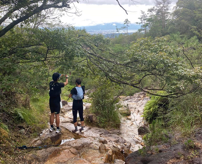
- 大平山~音羽山下山まではアップダウンが連続するが、木々の間からは琵琶湖を望める
- W2長等公園は各種飲料水と和菓子、カロリーメイト、ゼリーのみの提供
意外にガツンと登る。ウォーターエイドだけど、和菓子(明日香食品)とカロリーメイトやゼリー(大塚製薬)もあるよ!
⑦W2(長等公園)113.9km~A6(北白川小学校)125.8km A6関門時間 37時間(土曜日 22:10)
- 銀閣寺~北白川公園~バプテスト病院までは、熊鈴を鳴らさず、特に夜間早朝は静かに走行のこと
- 大文字山は日中はハイカーが大変多い山である。ハイカーを優先し、すれ違いや追い抜きは歩き、横を走り抜けたりしないこと
- 道路を横断する際は交通規則を遵守し、車に十分注意する
- A6北白川小学校には駐車場がないので、サポートする場合は近隣のコインパーキングを利用しエイドまで歩くこと。路上駐車は厳禁!
- 夜間、早朝は静かにすること
- 応援者は小学校敷地内には入らないこと(ビブを付けた人だけ入れる)
大文字山もロスト注意!A6はチョップ特製うどん!
⑧A6(北白川小学校)125.8km~A7(還来神社)149.6km A7関門時間 45時間(日曜日 6:10)
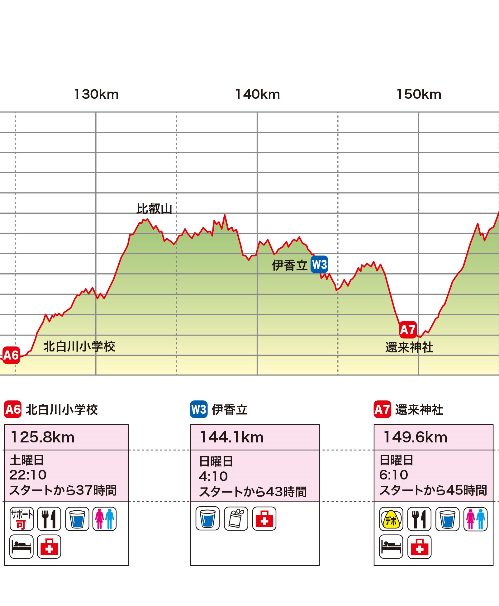
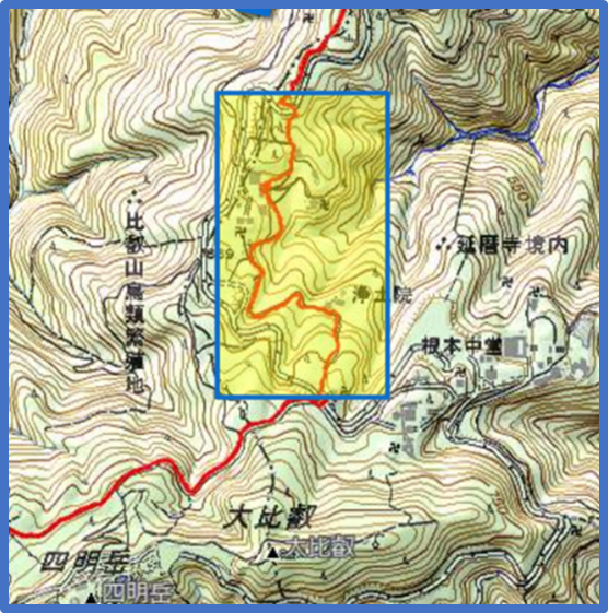
- 比叡山の山王院堂手前の奥比叡ドライブウェイ陸橋~浄土院~にない堂の約1kmは比叡山延暦寺参道につき、熊鈴を禁止とし徐行区間とする
- 仰木峠~還来神社は比良比叡トレイル(黄色のマーキングテープ)とLAKEBIWA100のコースはまったく同じ
- デポバッグ有り・仮眠場所あり(各自デポバッグに寝袋などを入れておくこと)
ロスト注意!A6北白川から18.3km地点にウォーターエイドがあるが、非常に時間がかかるため、十分な水分を携帯すること。無限ループと呼ばれる区間。
A7では卵スープご飯がまってる!
⑨A7(還来神社)149.6km~Finish(カーメルビーチクラブ前ビーチ)170km Finish関門時間 52時間(日曜日 13:10)
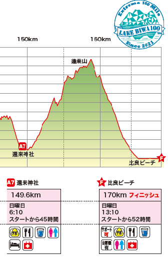
- 霊仙山、権現岳と急な直登が続く
- 蓬莱山からの琵琶湖は大絶景。今まで辿ってきた山々が一望できる
- 打見山のびわ湖バレイロープウェイ横の階段を下りてから、ガレた下りの入口を見失わないよう注意する
- 打見山を下ると残りは琵琶湖岸のロードを5km進む
- 舗装路に出たら熊鈴が鳴らないようにすること。
- 夜間、早朝は近隣住民に配慮し、山から舗装路に出てからゴールまでの区間や、ゴール付近で大声で騒いだりしない。
最後の大きな登りは、霊仙山、権現山、蓬莱山と3段階になっている。非常に長く時間がかかるので、十分な水分をもって進むこと。また下りも非常に長いので、蓬莱山の後のびわ湖バレイの自販機で必要に応じて補給すること。振り返りの絶景と、びわ湖ダイブを楽しんで!
注意事項
サポート
W1,A3,A4,A5,A6各エイドでの選手へのサポート(装備の交換、着替え、飲食料の提供等)を認める。A6北白川公園には駐車場が無いため、近所のコインパーキング等を利用すること。路上駐車は厳禁。
エイドでの規則
一般観客者・応援者等は、エイドのサポートエリア外で応援をしなければならない。夜間・早朝は、特に騒音が出ないよう地域に配慮する。
商店の利用
コース上の自販機や最寄りのコンビニの利用は可能とする。コースから外れて自販機やコンビニに行く場合は、コースを外れた地点まで戻ってからコースに復帰すること。